


Garmin TOPO Great Britain microSD Maps (Northern England & Midlands)


| $ 185.00 | |
| SKU | 010-C0927-00 |
Description
Warranty
Trek through the highlands and the lowlands with precisely-detailed topographic maps. TOPO Great Britain: Northern England & the Midlands includes terrain contours, topo elevations, summits, routable roads and paths, parks, coastlines, rivers, lakes and geographical points. These detailed maps are ideal for hiking, hunting, cycling and communing with nature.
- Coverage -
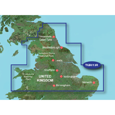
Includes topographic coverage of northern England from Northumberland National Park and Kielder Forest Park to the Midlands. Also includes Lowestoft, the Norfolk Broads and the northern part of Wales, including Snowdonia National Park.
- Features -
- Provides detailed digital topographic maps with topographic data from Ordance Survey of Great Britain.
- Contains summit locations with elevation, detailed contours, and trig points.
- Allows you to search by city, geographic point, summit, lakes and more.
- Provides elevation profile on compatible devices so you can estimate terrain difficulty.
- Contains many routable trails, tracks and paths.
- Includes points of interest such as parks, scenic lookouts and picnic sites as well as lodging, food, petrol stations and hospitals.